The front setbacks of NYC
Some Key Numbers
Area used for front setbacks: 289 Million square feet
If existing buildings had no front setbacks, this would add:
- 586 Million square feet of residential area
- 586K units 1,000 sqft per unit
An Overview
In NYC, rents are high, and there's a big effort to build more housing. But there's a hidden way that we lose housing, so common that it does not get talked about enough: Setbacks! Even though you might think NYC as a very dense city, front setbacks still matter, a lot.
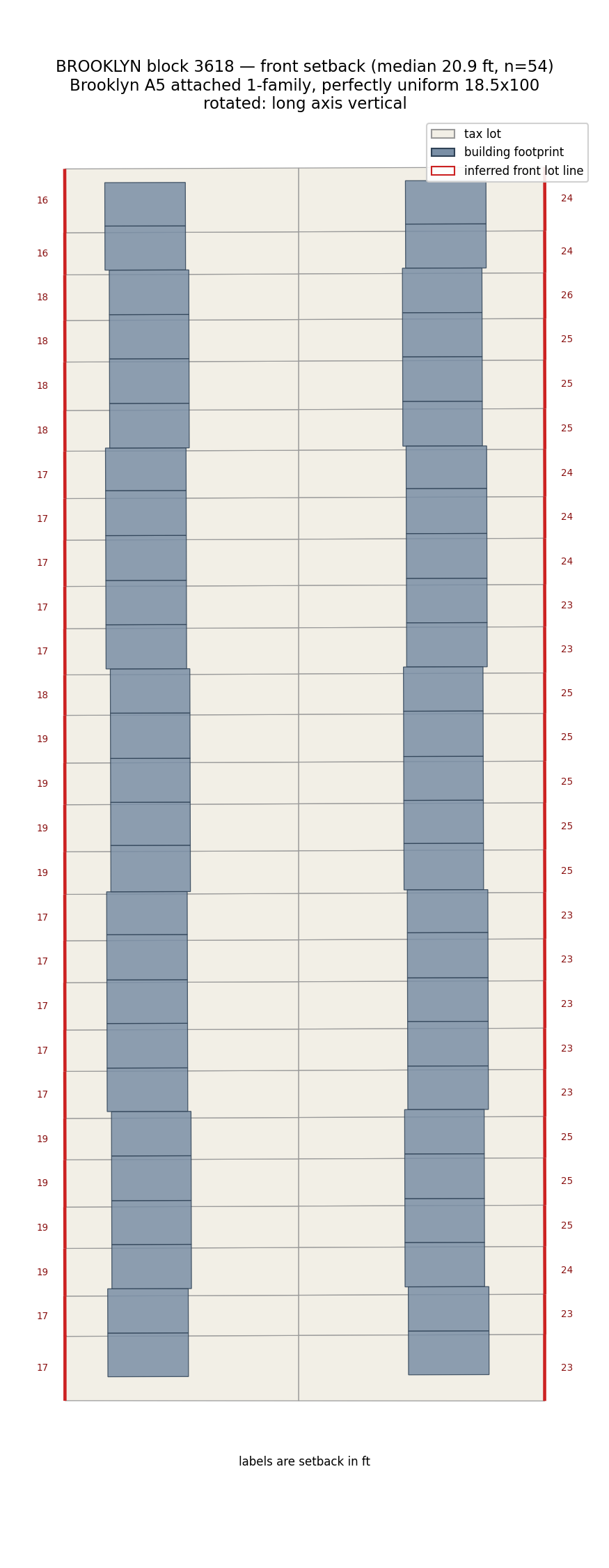
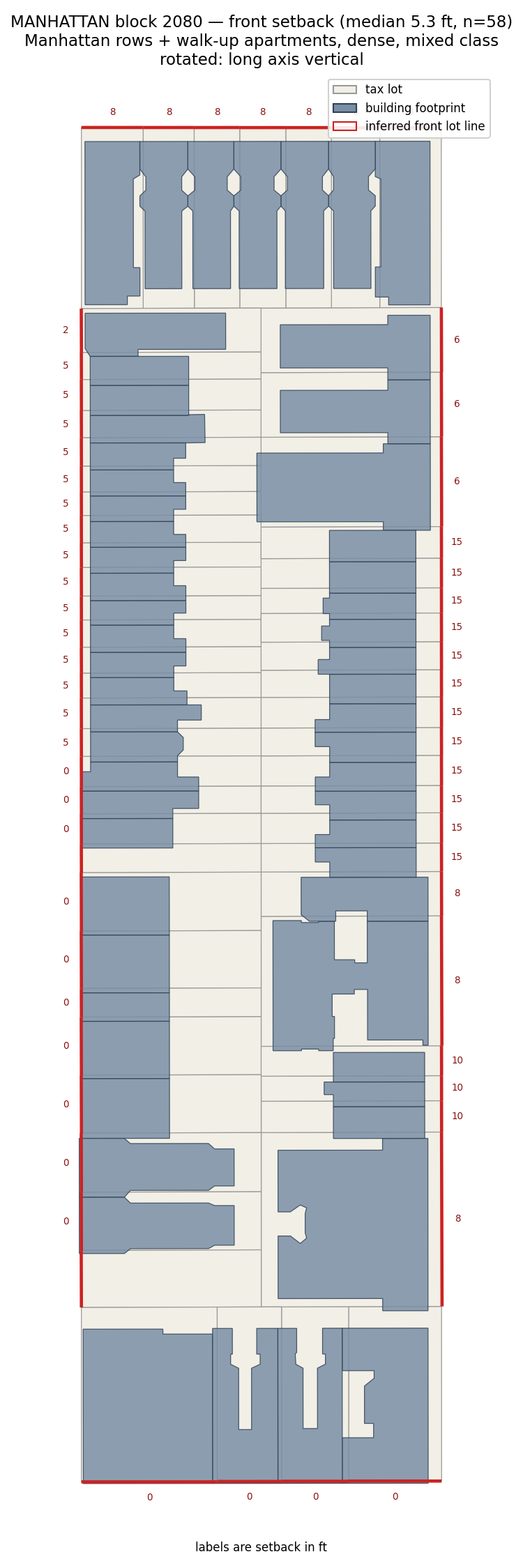
Almost always, it's the zoning code saying: You shouldn't build directly at the lot. Below, we'll give you three examples, with images we took ourselves. Can you see why we think that for 2 of 3 of these, there's probably a better space usage available?
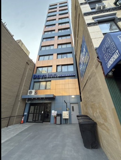
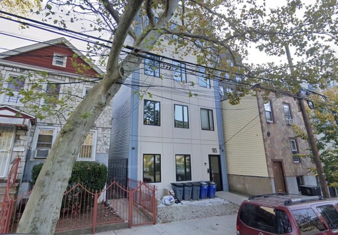
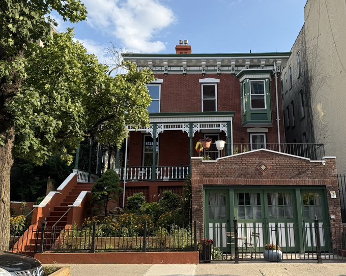
So far, we believe there hasn't been a way to comprehensively summarize the impact of these setbacks (let us know if we missed an analysis). So we ... calculated front setbacks, for all NYC lots.
Front setbacks: The overall data
City-Wide
- Median setback: 13ft
- Total setback area: 280 Million sqft
- Housing area not used:
- 586 Million sqft
- 586,000 units at 1,000 sqft/unit
The "housing area not used" is, in our view ,the best way to think of the cost of front setbacks. It's asking: What if the building were the same height, but went fully to the lot line instead of starting after the setback. If we did that, how much more housing area would we have?
See technical notes in the appendix at the bottom.
New construction?
An obvious retort: Lots of setbacks are from old buildings. Even if we might not like them now, we can't go back in time. Fair point, so let's look at more recent construction, summarized in the table below.
For builds still 2015, the median setback is almost 15ft, and interestingly, it's higher than for buildings constructed more than 100 years ago.
| era | lots (K) | median setback (ft) | median lot width (ft) | median floors | % on lot line | median sqft lost/lot |
|---|---|---|---|---|---|---|
| pre-1916 | 121.4 | 8.1 | 20.0 | 2.5 | 6.7 | 445 |
| 1916-1945 | 320.5 | 10.7 | 25.0 | 2.0 | 4.8 | 572 |
| 1946-1960 | 94.5 | 19.7 | 30.0 | 2.0 | 0.8 | 1,020 |
| 1961-1980 (post-1961 resolution) | 45.6 | 18.6 | 30.0 | 2.0 | 0.8 | 1,093 |
| 1981-2000 | 36.9 | 19.6 | 24.0 | 2.0 | 3.2 | 1,040 |
| 2001-2014 | 28.7 | 16.5 | 25.0 | 2.0 | 3.1 | 1,010 |
| 2015+ (new builds) | 7.5 | 14.1 | 30.0 | 2.0 | 4.9 | 1,066 |
Maps
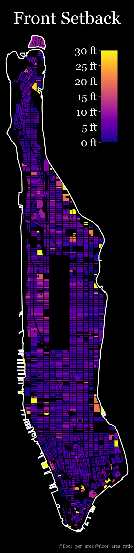
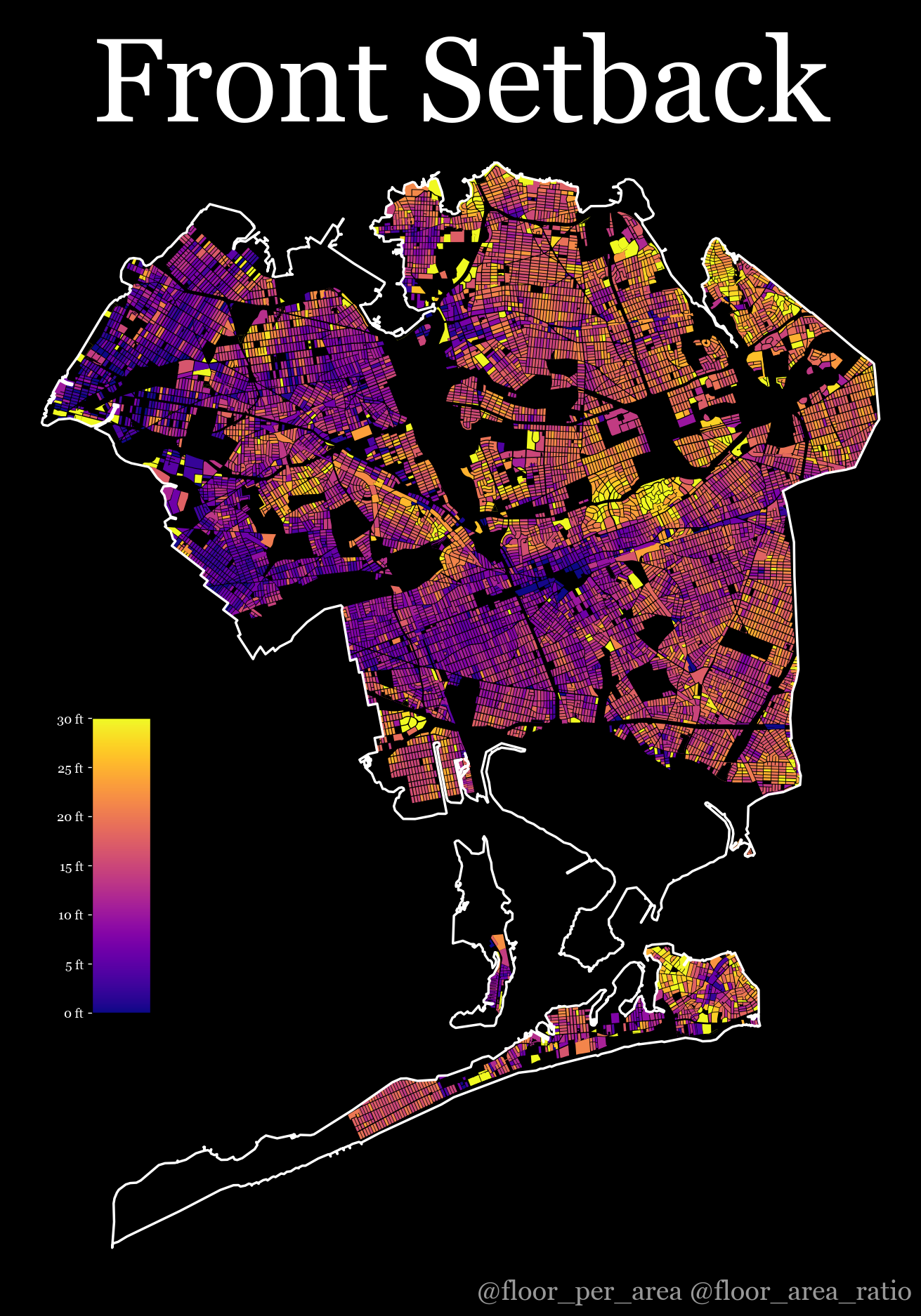
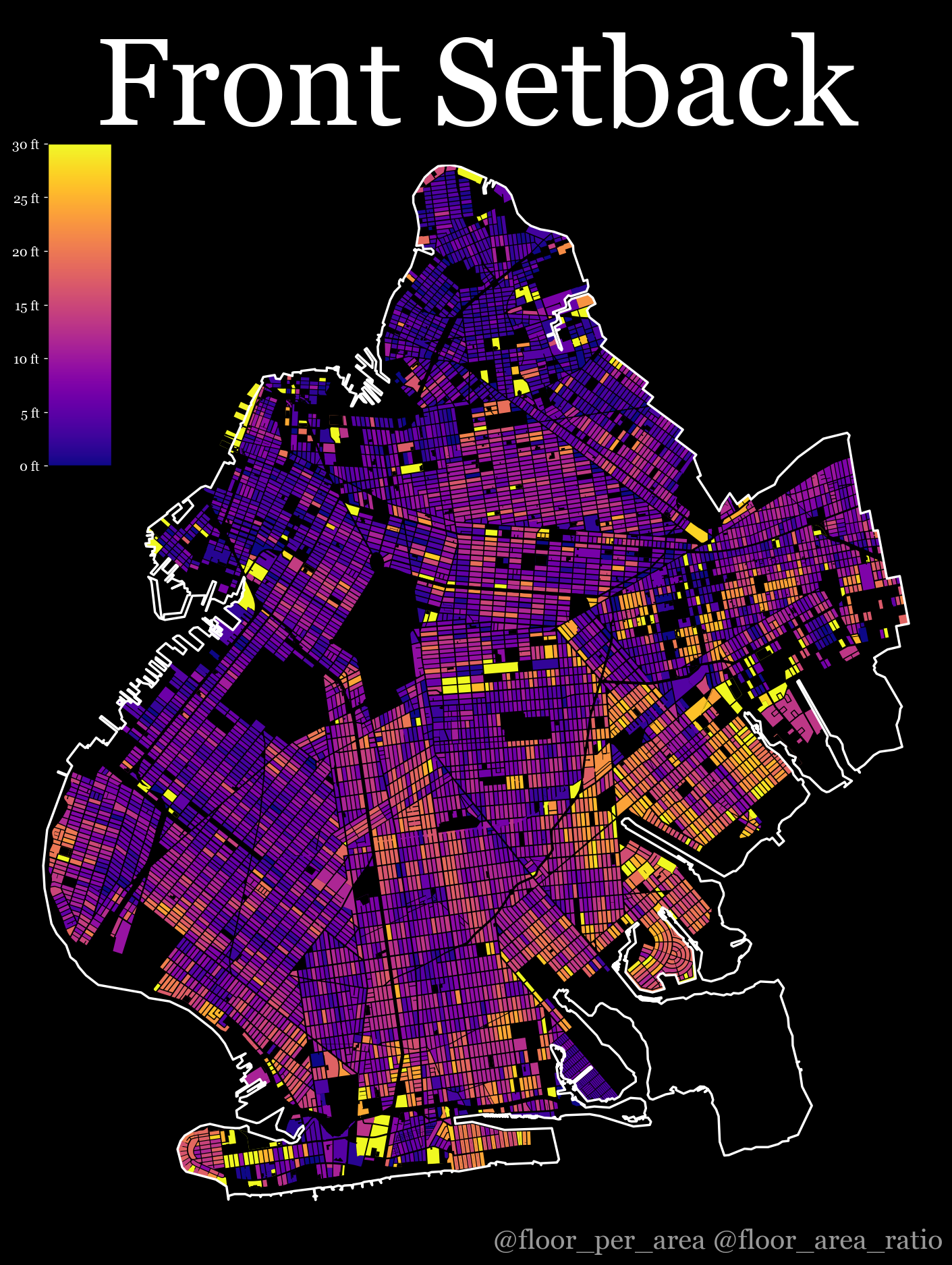
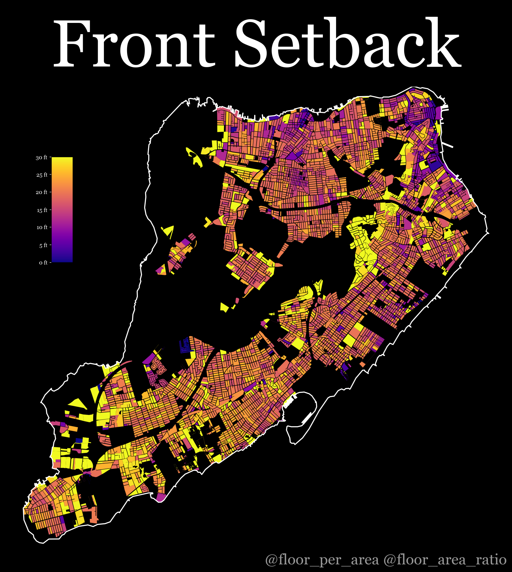
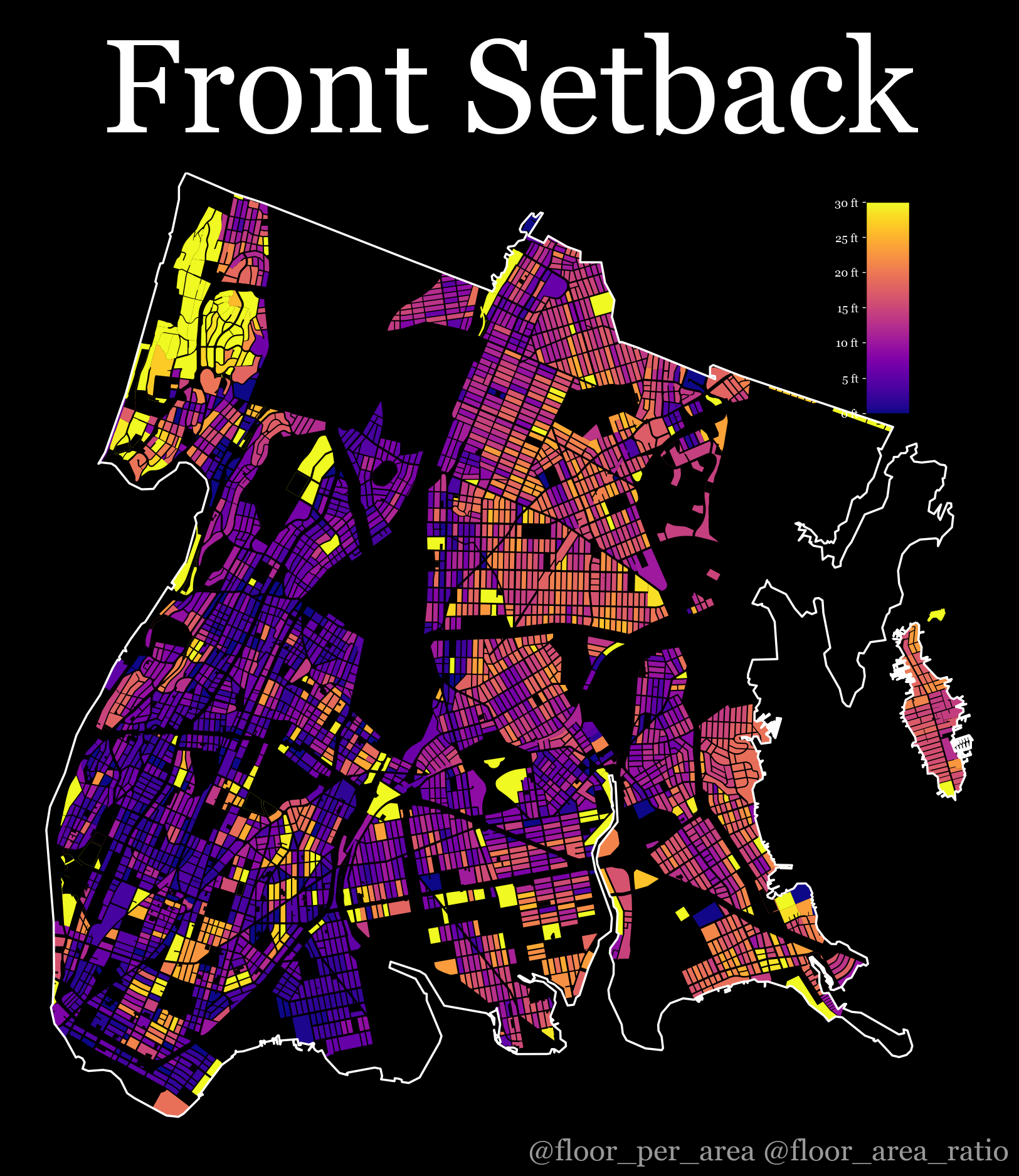
Let's look at this throughout the city. There's clear patterns here:
- Manhattan has the highest-value real estate, and the smallest front setbacks.
- And in general, denser areas have smaller setbacks, in line with the zoning code, e.g. in R6 and above, the required front setbacks are generally zero.
- But, overall, a huge share of the city still has big setbacks, often at 30ft.
Applications
Hotels in Manhattan
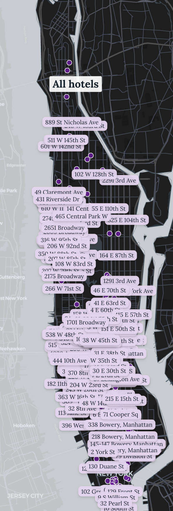
Hotels aren't directly housing, so they don't fall under the analysis above. But setbacks are still relevant for them: We find deep setbacks, even in Minhattan. With a curious wrinkle: These setbacks are all in Midtown and below. We don't yet know why, and are eager to learn about this from our readers.
The first image shows all hotels in Manhattan, which cover the island neatly. But when we restrict to those with 20ft+ of front setback, only hotels in Midtown and below remain, with the one above from 79 Eldridge serving as a good reminder of how this can look.
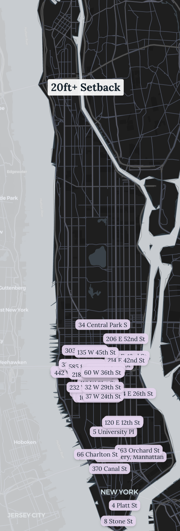
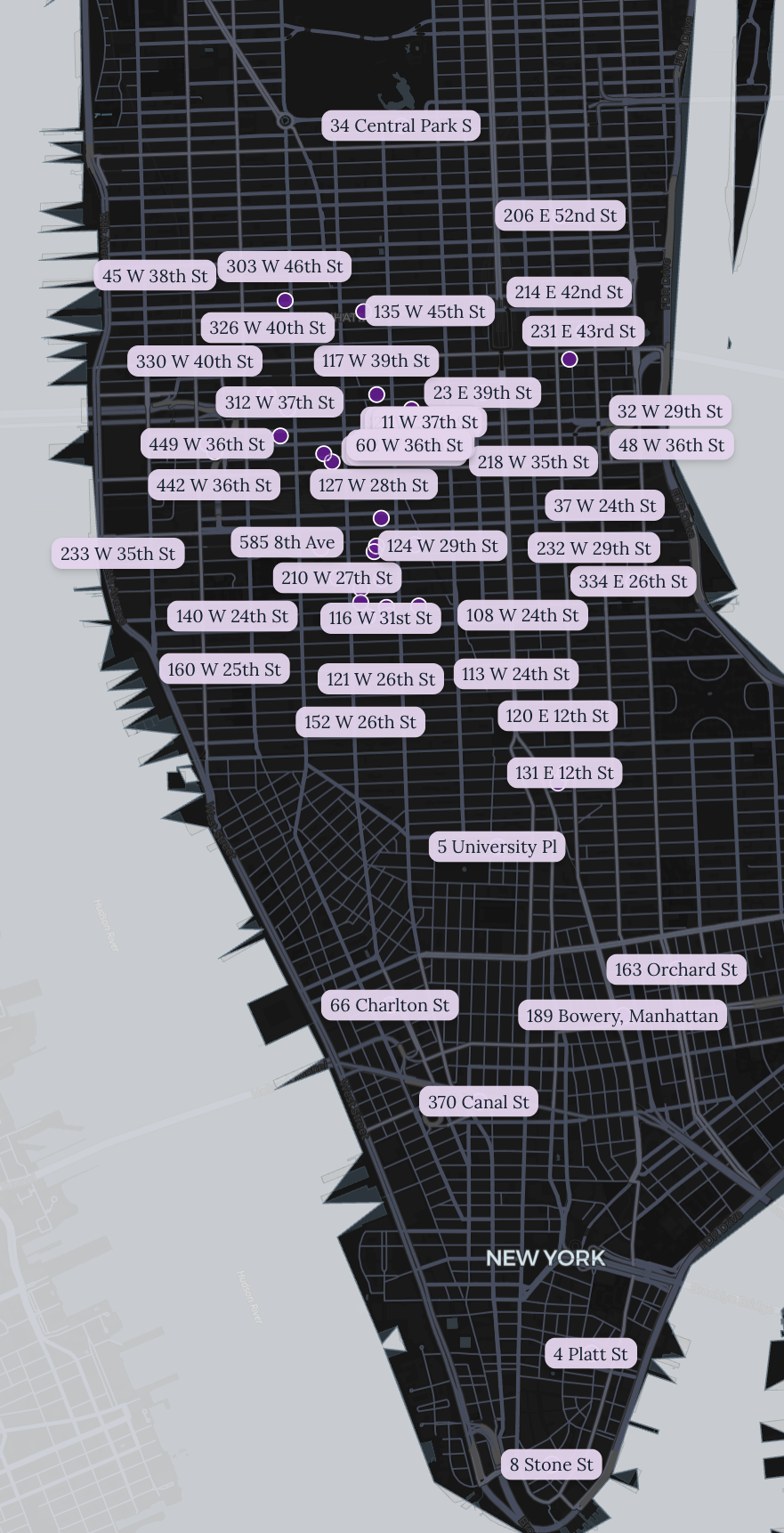
Of course, you can validate this yourself. The link below corresponds to the second image: See those results, look at the Street-view (part of the app) and help us figure out this riddle!


Appendix
Analysis Assumptions
Analysis assumptions. These should be conservative, since we restrict to a sub-set of lots for which front setbacks are well-defined.
- Housing area not used: Defined as setback area x building height. Think of this as "here's how much housing we'd add if every front setback were filled up with housing of the height after the setback".
- Restriction: Residential zoning, restricting to regular lots <=10,000 sqft.
Our Front Setback Calculation
The general idea is simple: The city gives us the shapes for tax lots and for buildings on those tax lots, and both of those are ingested into the CityTracker database. If we know the front of the lot, we can just calculate the distance to the building.